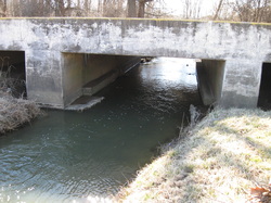
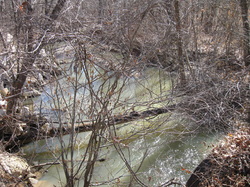
Site 1
OSK100-0001
Bridge on Allison Lane near Jeffersonville Fire Station, and intersection of Middle Road; Lancassange Creek
HUC 051401010605
Highly populated, growing business area; next to a re-claimed Brownfield site; southernmost location in Goose Creek watershed
Site 2
OSK-06-0003
Bridge at 4308 Blue Ridge Rd., Charlestown
HUC 051401010603
Close to IDEM sampling site on Bull Creek in Goose Creek watershed
OSK-06-0003
Bridge at 4308 Blue Ridge Rd., Charlestown
HUC 051401010603
Close to IDEM sampling site on Bull Creek in Goose Creek watershed
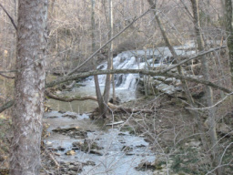
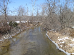
Site 3
Bridge on Flintridge Road at the intersection with Bethlehem Rd.
HUC 051401010601
Confluence of Camp Creek and Little Camp Creek in Goose Creek watershed
Bridge on Flintridge Road at the intersection with Bethlehem Rd.
HUC 051401010601
Confluence of Camp Creek and Little Camp Creek in Goose Creek watershed
Site 4
OSK070-001
Bridge on Tunnel Mill Road
HUC 051401010604
Confluence of Nine Penny, Big Branch, and Dry Branch, which were on 2012 303 (d) streams for E.coli, in Fourteen Mile Creek watershed
OSK070-001
Bridge on Tunnel Mill Road
HUC 051401010604
Confluence of Nine Penny, Big Branch, and Dry Branch, which were on 2012 303 (d) streams for E.coli, in Fourteen Mile Creek watershed

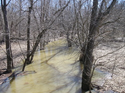
Site 5
Bridge on Salem Church Road
HUC 051401010404
Confluence of Yankee Creek and two unnamed tributaries in Fourteen Mile Creek watershed; livestock area
Bridge on Salem Church Road
HUC 051401010404
Confluence of Yankee Creek and two unnamed tributaries in Fourteen Mile Creek watershed; livestock area
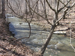
Site 6
Bridge on Gum Corner Road in Fourteen Mile Creek watershed
HUC 051401010404
2012 303 (d) stream for E.coli
Bridge on Gum Corner Road in Fourteen Mile Creek watershed
HUC 051401010404
2012 303 (d) stream for E.coli
Site 7
OSK070-00002
Bridge on Zimmerman Road east of New Market Rd in Fourteen Mile Creek watershed
HUC 051401010403
On the 2000 Corvallis list; confluence of Polk Run and 14 Mile
OSK070-00002
Bridge on Zimmerman Road east of New Market Rd in Fourteen Mile Creek watershed
HUC 051401010403
On the 2000 Corvallis list; confluence of Polk Run and 14 Mile
Site 8
OSK070-0014
Bridge on New Market Road north of Faye Amick Road in Fourteen Mile Creek watershed
HUC 051401010403
2012 303 (d) stream for E. coli
OSK070-0014
Bridge on New Market Road north of Faye Amick Road in Fourteen Mile Creek watershed
HUC 051401010403
2012 303 (d) stream for E. coli
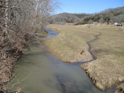
Site 9
Bridge on Westport Road close to intersection of New Market Road
HUC 051401010403
Accessible segment west of the Wastewater Treatment plant for New Washington and at the confluence of West Fork of Fourteen Mile and Fourteen Mile Creek; in Fourteen Mile Creek watershed
Bridge on Westport Road close to intersection of New Market Road
HUC 051401010403
Accessible segment west of the Wastewater Treatment plant for New Washington and at the confluence of West Fork of Fourteen Mile and Fourteen Mile Creek; in Fourteen Mile Creek watershed
Site 10
OSK07-0015
Bridge on 362 west of State Rd. 62 between Frank Fisher and Kettle Bottom Road in Fourteen Mile Creek watershed
HUC 051202070502
2012 303(d) stream segment, E.coli, Dissolved Oxygen and IBC
OSK07-0015
Bridge on 362 west of State Rd. 62 between Frank Fisher and Kettle Bottom Road in Fourteen Mile Creek watershed
HUC 051202070502
2012 303(d) stream segment, E.coli, Dissolved Oxygen and IBC
